


Neighborhood Maps
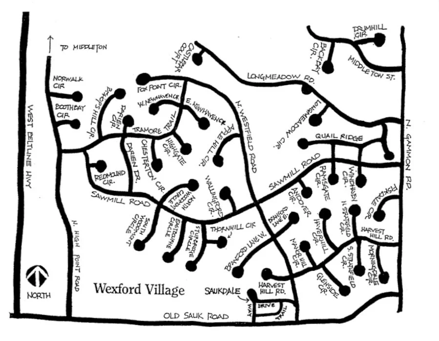
1. Streets of Wexford Village above
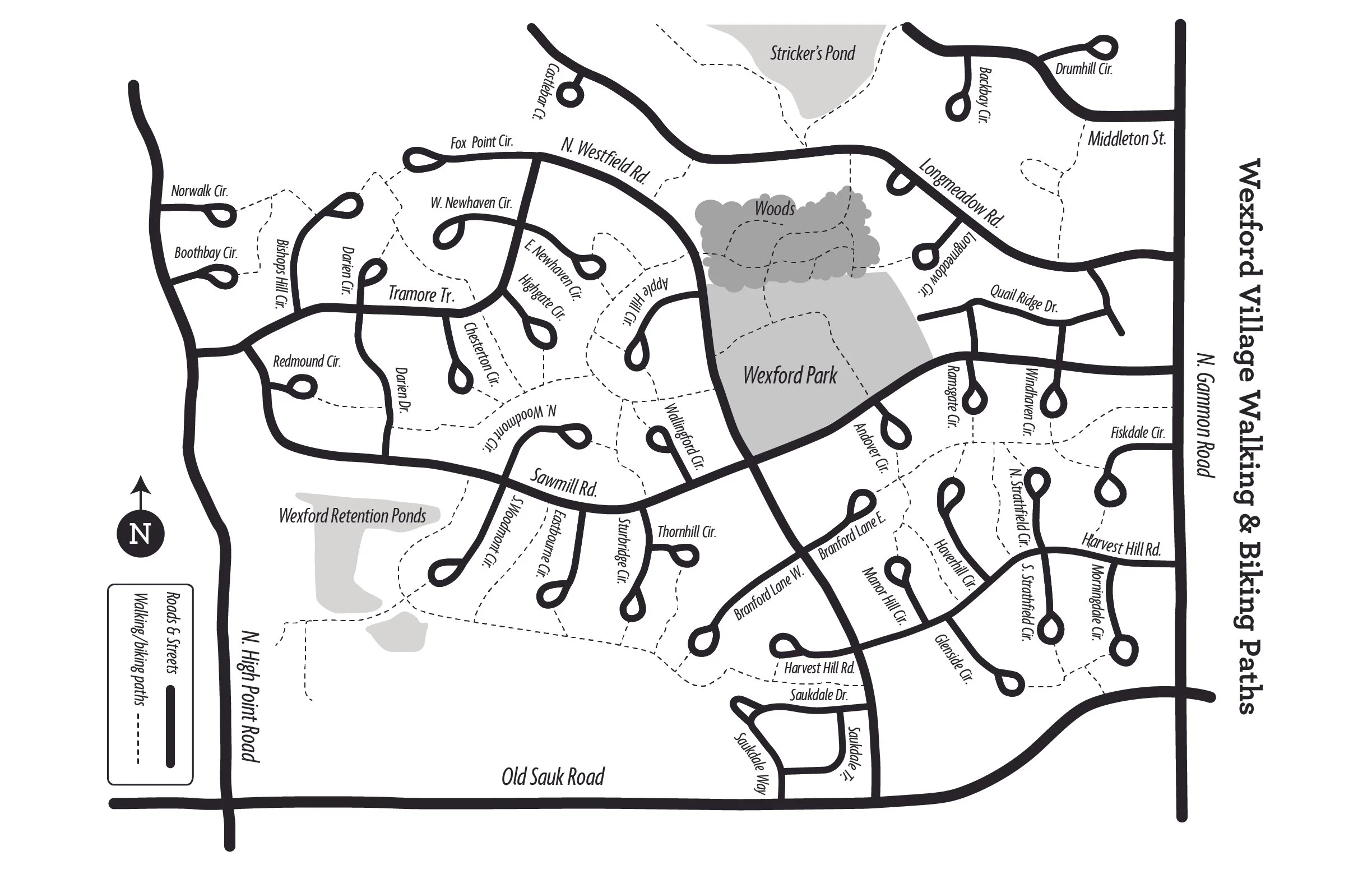
2. Biking & Walking Path Map in Wexford Village above

3. Land use map for Wexford Village above
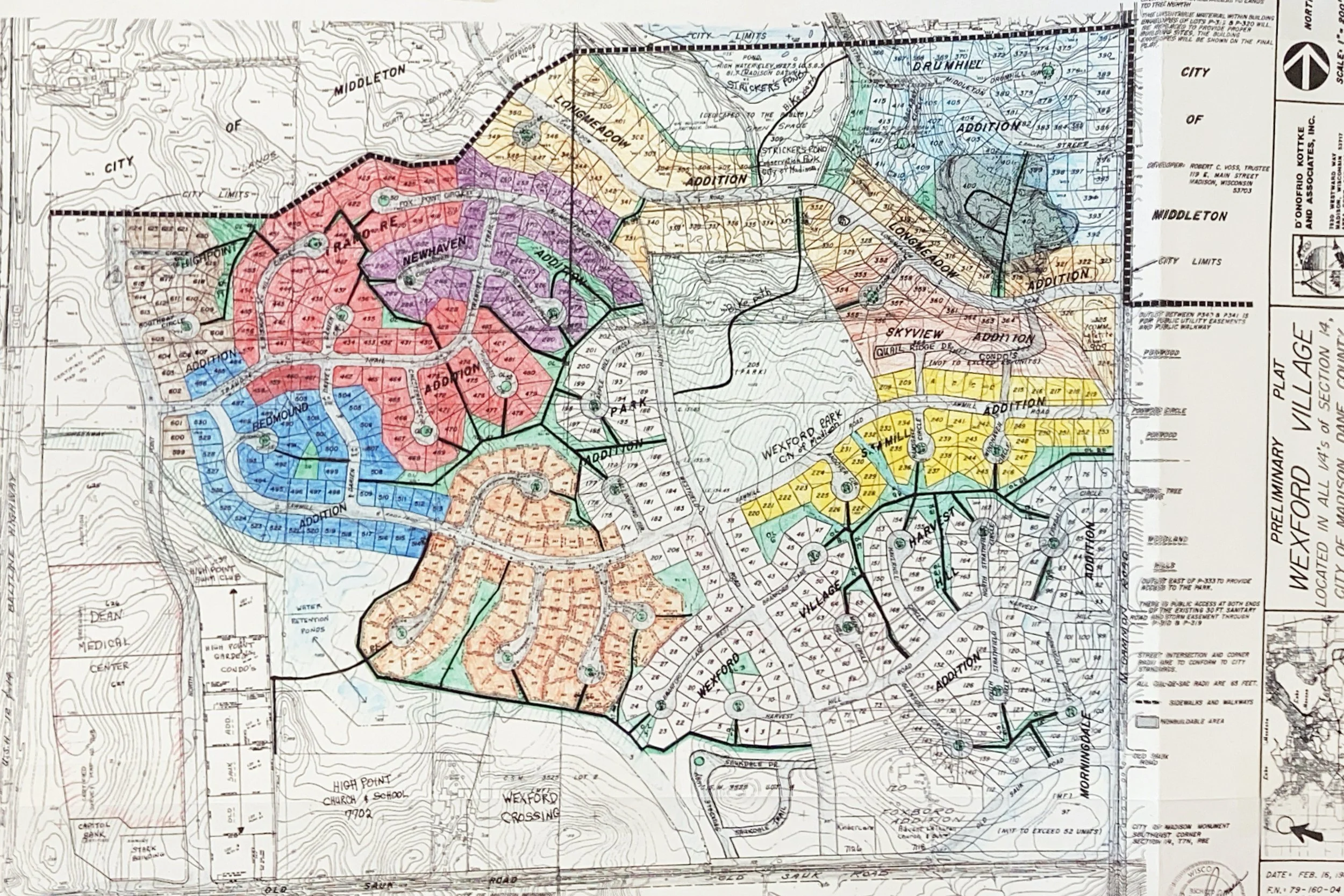
4. Wexford Subdivision Map above
5. Explanation of subdivision numbering system—Click Here—very interesting!
6. Subdivisions by streets—Click Here—wondering what subdivision YOU live in?
7. Wexford Village Plat Map—Click Here—for a larger, more detailed PDF of the neighborhood
8. The Neighborhood Indicators Project has data from 2024 on Wexford and all other neighborhoods in Madison from housing, census, public safety, health, education and transportation. https://madison.apl.wisc.edu/